Tillsonburg
Tillsonburg's Development & Incorporation
Originally known as Dereham Forge, Tillsonburg was first settled along Big Otter Creek in 1825 by George Tillson, Benjamin Van Norman and other immigrants from the United States. Iron ore in the vicinity led to the construction of a forge, and soon a sawmill was erected. Although the forge was only successful for a short period of time, new settlers continued to arrive in the area and new businesses and roads were built.

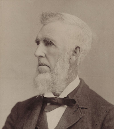
Portrait of George Tillson [courtesy of Annandale N.H.S. & Museum]
In 1836, the village was renamed Tillsonburg in honour of George Tillson. That same year, the main street, Broadway, was laid out to its full 100-foot width. As a predominantly logging and wood producing centre, it is said that, the road was designed to accommodate the turning of three-team logging wagons.
Industrialization of the community relied heavily on the waterways, with the establishment of sawmills, planning mills, grist mills, pottery factories, as well as tanneries, to either power their industries or to carry their goods to Port Burwell on Lake Erie. Many of these early businesses were either owned, started or financed by Tillson family.

Map of Tillsonburg from an 1874 atlas

Postcard of the "lower dam" in Tillsonburg, Ontario

"The flour mill" in Tillsonburg, Ontario

Advertisement for John Smith's saw and planing mill in Tillsonburg from the 1881 directory.
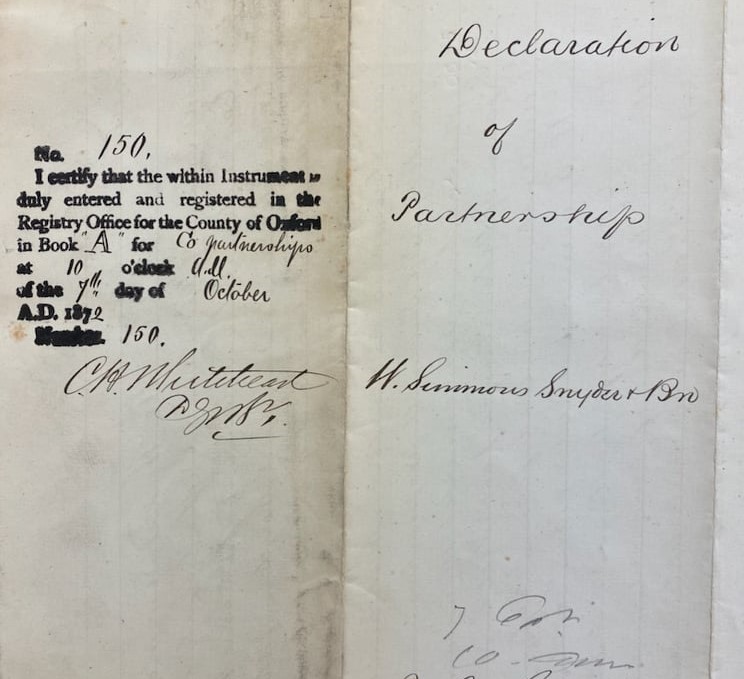
In 1865, Tillsonburg was erected as a Police Village, though this status was only short lived. Soon members of the community were pushing for improved municipal status with the objective to secure incorporation as either a town or a village. In 1872, the bill to incorporate Tillsonburg as a town received third reading on February 23rd, and assent a month later, on March 2nd. Edwin Delevan (E.D.) Tillson was elected as the town’s first mayor

By-law no. 1 for Tillsonburg, "for the purpose of appointing Town Officers to serve in this municipality for the current year", 25 March 1872. [courtesy of Annandale N.H.S. & Museum]
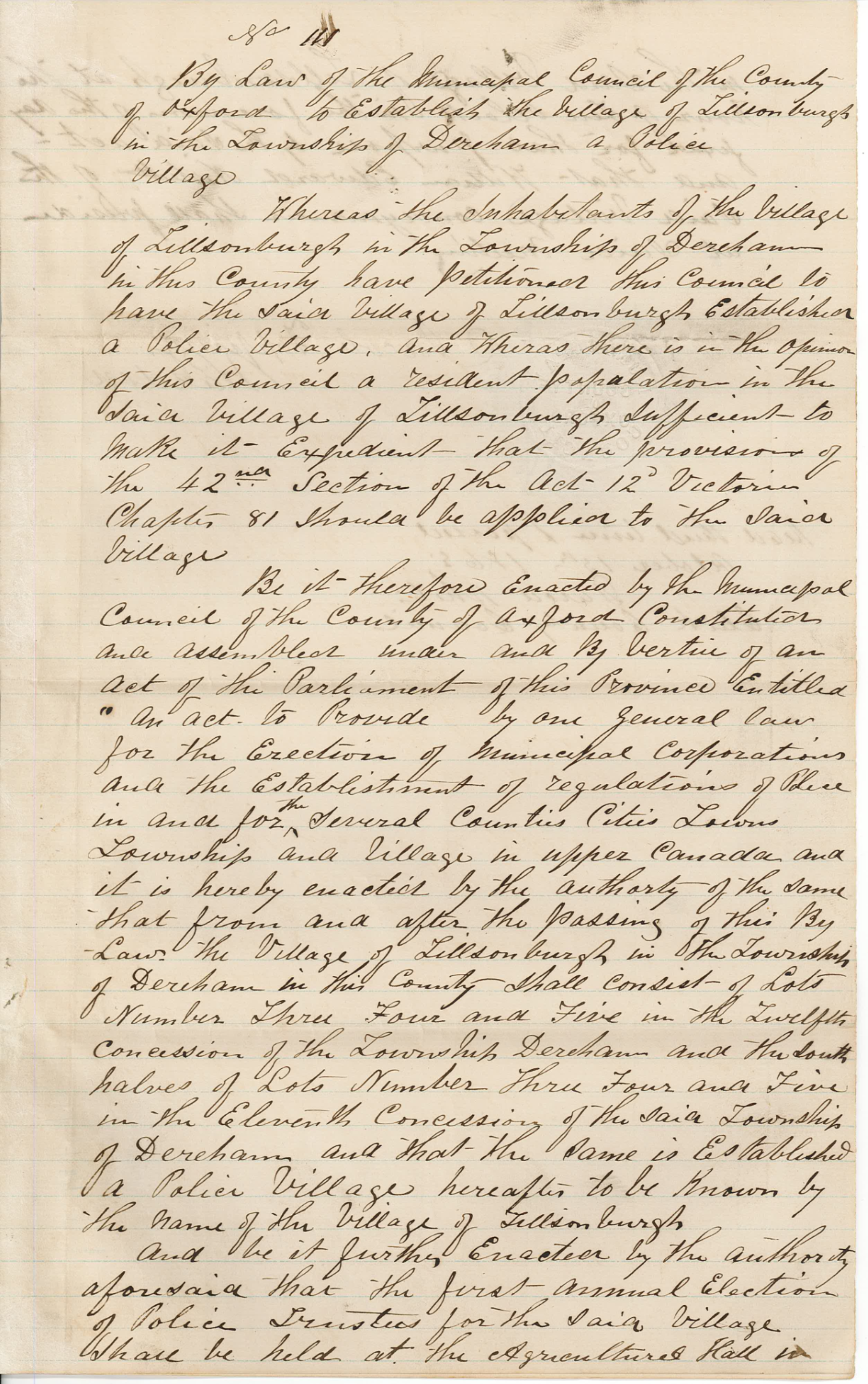
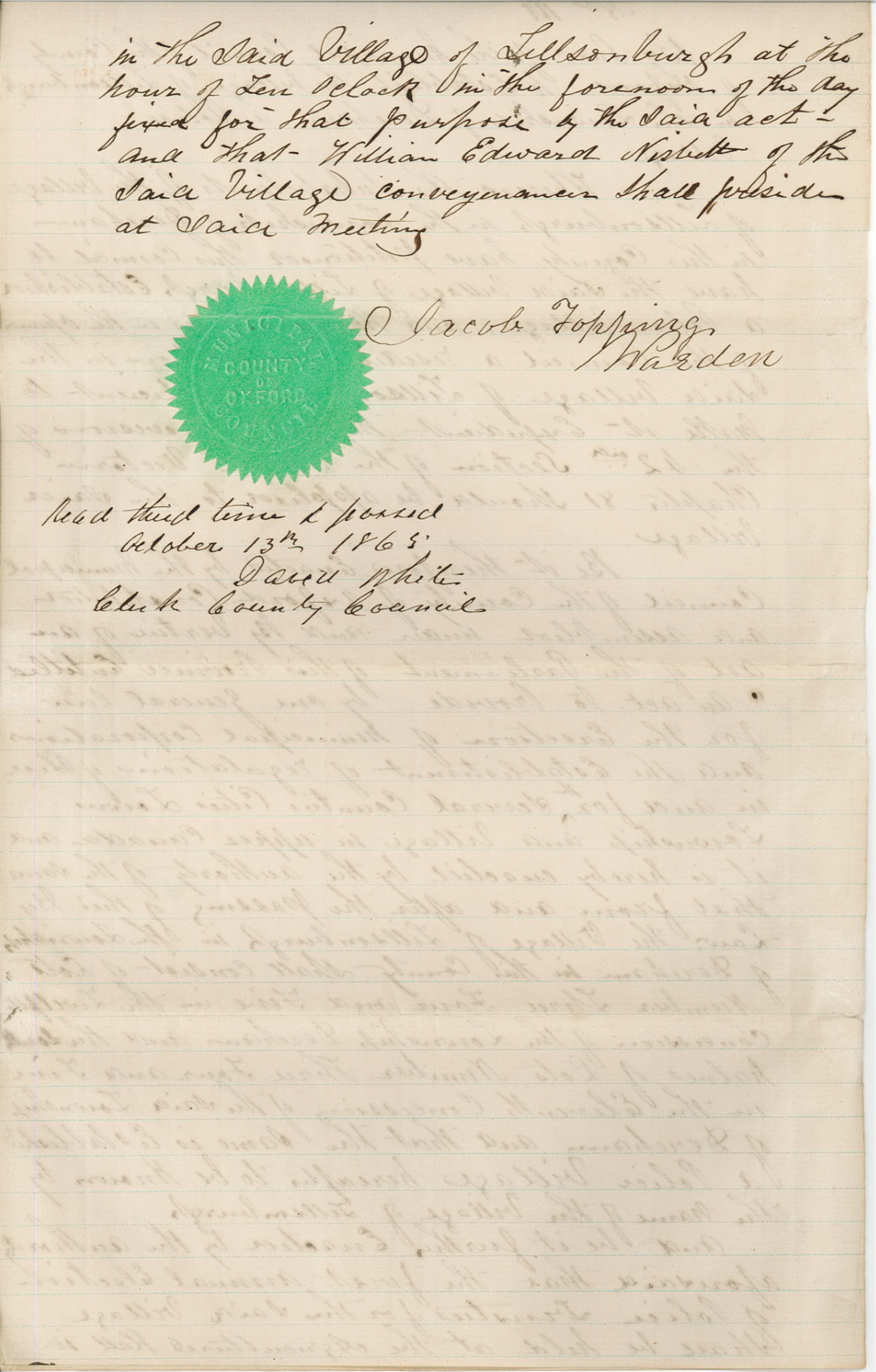
By-law no. 111, establishing Tillsonburg as a "police village", 13 October 1865.
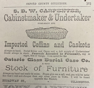
By the early 1870s, the area had reached a population of about 1,000 and consisted of a number of general stores, grocers, boot and shoe shops, blacksmiths, grist mills, and a woolen factory, just to name a few of the growing businesses. A decade later, the population had soared over 3,000 with the introduction of new businesses, such as a Split Pea & Barley Mill, a large sugar manufactory, and a factory for the evaporation of fruit. E.D. Tillson was instrumental in many of these new business ventures.
Let’s explore some of these early businesses and the men and women behind them!
A note of thanks:
The Archives would like to thank the staff at Annandale National Historic Site and Museum for their assistance with research and for providing images. For those wishing to learn more about the history of Tillsonburg, please visit the museum’s website: https://www.tillsonburg.ca/recreation-and-culture/annandale-national-historic-site-and-museum/